
Nantucket Zoning Map
Nantucket Zoning Map
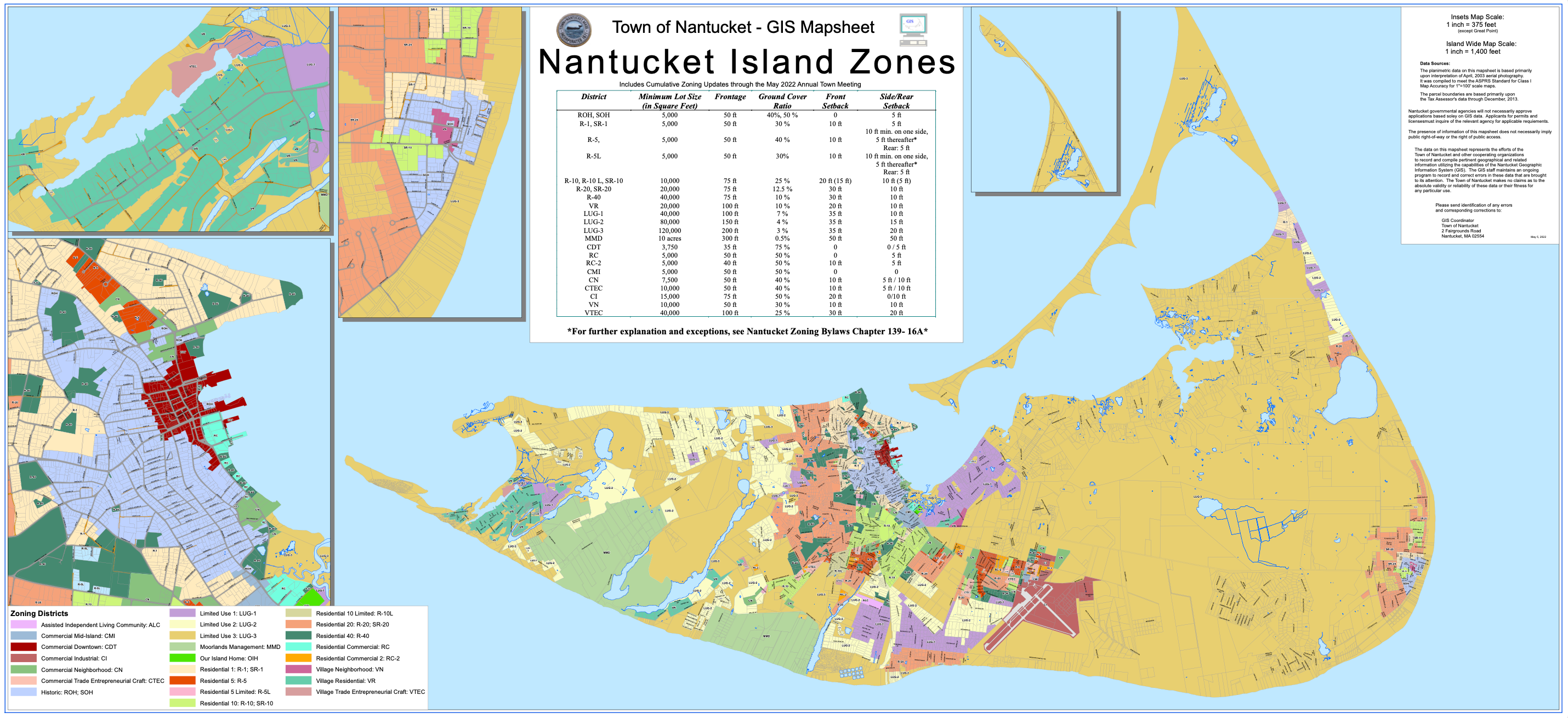
Nantucket zoning maps are official maps that designate land use zones. These maps outline different zoning districts, such as residential, commercial, and overlay districts, which dictate the types of development and activities allowed in specific areas.
The maps are used for planning, property development, and regulatory enforcement. They typically show:
Zoning district boundaries
Allowed land uses (single-family homes, commercial businesses)
Building regulations (lot sizes, setbacks, height limits)
Overlay districts (historic districts, flood zones, coastal protection areas)
These maps are maintained by the Nantucket Planning & Land Use Services (PLUS) department and the Nantucket Zoning Board of Appeals. If you’re looking for the latest zoning maps, they can typically be found on the Town of Nantucket’s website.
 Interactive Zoning Map
Want to learn more about buying a home on Nantucket and all the important regulations that go along with it? Connect with a GPP Agent!